Poole Harbour: The Complete Navigator's Guide for Powerboats & Personal Watercraft
- Rian
- May 21
- 10 min read

Poole Harbour is, by surface area, one of the largest natural harbours in the world. It is also, depending on the state of the tide, the time of year, the direction of the wind and the confidence of the person at the helm, either a sublime playground or a fairly efficient mechanism for making expensive mistakes.
Whether you're arriving in Poole for the first time aboard a powerboat, planning a jetski session off Sandbanks or simply wondering why someone has positioned a whopping great chain across the harbour entrance during a busy Saturday afternoon — this guide is for you. It covers everything from the harbour's famously peculiar tides to the local byelaws that apply specifically to personal watercraft operators, written in plain English by people who spend a considerable amount of time on this water.
Here at New Wave Training we deliver RYA Powerboat and RYA Personal Watercraft (PWC) training in and around Poole Harbour. We know where the sand bars are at low water. We know what the chain ferry does to your carefully planned crossing. And we know why understanding tides here requires slightly more attention than most UK locations.
Understanding Poole Harbour's Double Tides
Poole Harbour has one of the more unusual tidal patterns in the British Isles — and quite possibly the world. Rather than the standard two high waters and two low waters per day that most sailors learn about in their first week, Poole produces a phenomenon known as a double high water, sometimes called an agger. In practical terms, the tide rises, pauses, dips slightly, then rises again before the full ebb begins.
The cause lies in the resonance of the English Channel itself. Tidal waves travelling from the Atlantic interact with reflected waves bouncing back up the Channel and, where they meet — broadly around the Dorset coast — the result is a tidal curve that looks less like a clean sine wave and more like something drawn by someone who changed their mind halfway through.
What This Means in Practice
The harbour can experience a high water stand — a prolonged period where the water level remains largely stable — lasting several hours. During spring tides, water can remain high for up to four or five hours, which sounds helpful but can be deeply misleading when planning a passage. The ebb, when it eventually arrives, can be swift and powerful.
Navigator's Note: Always cross-reference your tidal times with a Poole-specific tidal curve, not just the tabulated high and low water times. The shape of the curve matters enormously here. The Poole Harbour Commissioners website provides current tidal information.
For powerboat and jetski operators, the practical upshot is this: areas that appear perfectly passable at high water can become grounding hazards within a matter of hours. The inner harbour — particularly around Holes Bay, the north shore shallows, and the Personal Watercraft or Jetski area north of Brownsea Island — requires careful attention to depth at all states of the tide.
Key Navigational Hazards in Poole Harbour
Poole Harbour rewards those who pay attention to the chart. It is not, by the standards of some UK passages, a technically demanding waterway — but it has enough variety of hazard to keep things interesting, particularly at low water springs when the harbour reveals rather more of itself than most visitors anticipate.

Hook Sands & The Swash Channel
The Swash Channel is the main navigable approach to Poole from the east, running between Studland Bay and the Hook Sands banks. It is well buoyed and perfectly navigable — but the Hook Sands themselves dry significantly at low water springs. The buoys mark the channel edges; treat them with respect.
Cutting corners is how boats end up parked on sand rather than proceeding to their destination.
The Swash Channel is also used by commercial vessels. Maintain a good lookout, keep to the channel, and monitor VHF Channel 14 (Poole Harbour VTS) when transiting.
The Sandbanks Chain Ferry
The Sandbanks Ferry — a vehicle-carrying chain ferry operating between Sandbanks and Shell Bay — crosses the main channel throughout the day. It is large, slow, and entirely unable to deviate from its fixed path. It has right of way. Always.
The chains run along the harbour bed between crossings, but the ferry's crossing zone must always be treated with caution. If the ferry is moving when you approach, wait. This is not a situation for improvisation, creative interpretation of the Collision Regulations, or optimistic throttle work.
The Training Bank
The Training Bank runs along the side of the main channelon the approach to Poole Harbour, on the Studland side. It is marked by posts and easily visible at low water — because large sections of it are dry. At mid-tide and above it becomes invisible and represents a real grounding hazard for anyone navigating outside the buoyed channel.
Keep to the marked water. The bank was constructed to keep the harbour entrance navigatible. It does this very effectively.
Shallow Inner Harbour Areas
Much of Poole Harbour away from the main channels is extremely shallow at low tide. The areas around the north shore, Holes Bay, and the shallows to the north of Brownsea Island can be measured in centimetres at low water springs rather than metres.
Personal watercraft operators are particularly vulnerable here: jet intakes that ingest sand and mud cause significant impeller and pump housing damage. Repairs are rarely cheap. Know your depth, know the tide, and when in doubt, don't try it.
Commercial Traffic
The main channel is used by cargo vessels, passenger ferries and the Brittany Ferries service. These vessels have restricted manoeuvrability and constrained draught in the channel. Keep well clear, monitor VHF Channel 14, and never impede commercial traffic.
Speed Restriction Zones — Sandbanks & Studland Bay
Poole Harbour and its approaches operate under clearly defined speed restrictions, and the Harbour Commissioners take enforcement seriously. Check them out below:
General Harbour Speed Limit
The general speed limit within Poole Harbour is 10 knots. This applies across the majority of the harbour. Certain areas impose lower limits, and these are enforceable byelaws, not advisories.
Seasonal Speed Restriction Zones — Sandbanks & Studland Bay Beaches
During the summer months, typically from late spring through to early autumn, seasonal speed restriction marker buoys are deployed along the beachfronts at Sandbanks and Studland Bay. These buoyed zones create a buffer between on-water users and swimmers, paddlers and those enjoying the shoreline.
Within these seasonal zones, the speed limit is reduced. The markers are clearly visible and the zones are enforced.
Sandbanks and Studland are among the most popular beaches on the south coast. In summer, the water's edge is shared by families, wild swimmers, kayakers and paddleboarders who have every right to be there. A jetski or powerboat at speed in that environment is not merely inconsiderate — it is genuinely dangerous.
Important: Seasonal marker buoys can vary in position year to year. Before the season begins, check the Poole Harbour Commissioners website for the latest Notice to Mariners regarding speed restriction zone positions. Ignorance of zone boundaries is not a defence.
Best Wind Directions for Poole Harbour & Approaches
Poole Harbour is well sheltered by surrounding land, which generally makes conditions inside calmer than offshore. However, the harbour entrance and the approach across Bournemouth Bay can be very different in character from conditions inside.
SW (Prevailing) — Favourable: This wind direction is by far the most favourite for local who want to enjoy a day out on the water, access to most of the harbour and Studland/Swannage Bays is much better due to protection from the Purbeck Hills.
W / NW / N — Generally Good: Sheltered inner harbour, manageable Swash Channel approach. Good conditions for training and recreational use.
SE / E — Use Caution: Onshore wind builds a short, steep chop in Poole Bay and the harbour approaches. The Swash Channel can become uncomfortable. Not ideal for novice operators.
Local Knowledge: The Met Office Inshore Waters Forecast for Portland to Selsey Bill gives the most operationally useful guidance for this area. Always check conditions at the harbour entrance specifically before transiting — conditions inside can feel deceptively calm.
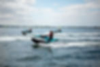
Hazards Specific to Jetski & Personal Watercraft in Poole Harbour
Personal watercraft are superb fun. They are also capable of covering a very large amount of water very quickly, which means mistakes happen at pace. Poole Harbour presents a specific set of considerations for PWC operators.
Water Intake & Shallow Water
Unlike propeller-driven craft, personal watercraft use a jet propulsion system that draws water through an intake on the hull. In shallow water, this intake ingests sand, mud and weed — causing damage to the impeller and pump housing that is rarely cheap to fix. Poole harbour shallows and the areas around the Training Bank are particular risks. If the water looks questionable, it almost certainly is.
Speed, Manoeuvrability & Complacency
Modern personal watercraft are remarkably capable machines. This capability, combined with the relative ease of operation, can create a false sense of security. Poole Harbour is shared with kayaks, paddleboards, sailing dinghies, swimming children and the occasional confused seal. High speed in congested or restricted areas is both illegal and genuinely dangerous.
Visibility at Speed
At 30–40 knots, the time between spotting an obstacle and impact is measured in fractions of a second. In a harbour with commercial traffic, a chain ferry, recreational users and seasonal swimmer zones, maintaining a proper lookout is critical. Ride at speeds that allow time to react.
RYA Personal Watercraft Proficiency: The RYA PWC course delivered by New Wave Training covers all of the above — kill cord discipline, rules of the road, speed awareness, and practical on-water handling in Poole Harbour. If you're new to jetskis or new to this harbour, it's the most efficient investment you'll make. Find out more →
Anchoring Safely Near Tourist Beaches
On a warm summer's day, anchoring off Studland or Sandbanks has an obvious appeal. The water is clear, the views are excellent, and the general ambience leans heavily towards "why doesn't everyone do this more often." It does, however, come with considerations worth understanding before you put the hook down.

Swimmer Proximity
Sandbanks and Studland are among the busiest beaches on the south coast in summer. The water between an anchored vessel and the beach can be dense with swimmers, particularly children. A vessel swinging on its anchor as the tide turns can cover a significant arc — an area clear when you anchored may have several swimmers in it an hour later. Think carefully before choosing your spot.
Tidal Swing
As the tide turns, an anchored vessel swings to face the new current direction. In an area with other anchored boats, this swing can bring vessels dangerously close together. The scope you have out determines your swing radius. Be aware of what is around you in all directions, not just where you happen to be pointing when you set the anchor.
Underwater Infrastructure
Studland Bay in particular has laid moorings, environmental monitoring equipment and other seabed infrastructure. Check the chart before anchoring and do not anchor in designated exclusion areas.
Tenders & Dinghies Near Beaches
If you are anchored off and using a tender to reach shore, you are operating a powered craft near a bathing beach. All the same speed restrictions and seamanship considerations that apply to your main vessel apply equally to the tender. A small RIB at full throttle near a crowded beach is not good seamanship — it is a safety concern.
Studland Bay — Environmental Sensitivity: Studland Bay is a designated Site of Special Scientific Interest (SSSI) containing seagrass meadows of significant ecological importance. Anchoring directly on these areas causes physical damage to the seagrass. A voluntary no-anchor zone operates in parts of Studland Bay. Check Poole Harbour Commissioners guidance and the National Trust for current zone information before anchoring.
Poole Harbour Byelaws
Poole Harbour is managed by the Poole Harbour Commissioners, a statutory harbour authority with powers to make and enforce byelaws. These are enforceable rules. The following are the key byelaws most relevant to powerboat and personal watercraft operators.
Speed Limit — 10 Knots: The general speed limit within the harbour. Reduced limits apply in specific areas and during seasonal swimmer protection periods.
Designated PWC Areas: Personal watercraft are subject to specific restrictions on where they may operate. Some areas may be restricted entirely. Check current notices at phc.co.uk.
Right of Way — Commercial Vessels: Vessels with restricted maneuverability or constrained depth in the main channel have right of way. Keep clear. VHF Channel 14 is the working channel for Poole Harbour — monitor it when underway.
Alcohol & Drug Impairment: Operating a vessel while under the influence of alcohol or drugs is an offence under the Merchant Shipping Act. There is no maritime equivalent of the "it was only a couple" defense.
Registration: Personal Watercrafts in Poole have to pay for a harbour permit regardless of length of time on the water. For the complete, authoritative and current byelaws, visit the Poole Harbour Commissioners website.
Local Marinas & Fuel
Poole Quay Boat Haven
Located in the heart of Poole, the Boat Haven offers visitor berths for short stays adjacent to the Town Quay, with direct access to the old town, restaurants and amenities. The approach follows the main channel and is straightforward in reasonable conditions. Ideal for those arriving from outside the area.
Salterns Marina — Marine Fuel
Salterns Marina, situated on the north shore of the harbour in Parkstone, is facility with pontoon berths and a range of services. For powerboat operators in particular, it is a key marine fuel point within the harbour, with both petrol and diesel available. Confirm current operational hours before making a special trip for fuel.
Fuel Planning: Marine fuel availability within Poole Harbour requires planning rather than assumption. Personal watercraft burn fuel quickly. Identify your fuel stop before you need it — not when the gauge is making decisions for you.
RYA Training on the South Coast
Poole Harbour is an excellent training environment. It is enclosed, well-buoyed, generally sheltered, and contains within its boundaries a representative range of the hazards, traffic types and navigational considerations that any competent powerboat or personal watercraft operator needs to understand. It also has some fairly effective natural consequences for those who haven't quite established a working relationship with tidal curves.
New Wave Training delivers RYA Powerboat Level 2 and RYA Personal Watercraft Proficiency courses from Poole, using the harbour and its approaches as the training ground. The courses are internationally recognised, practically focused, and taught by qualified RYA Instructors who know this water well.
Why Train With New Wave Training? We're based in Poole. We train on Poole Harbour. The local knowledge built into every session — the tides, the chain ferry, the Training Bank, the speed restriction zones — isn't theoretical background. It's the actual environment you'll be operating in. Book a course →
For more on RYA qualifications and what each course involves, visit rya.org.uk/training.
Test Your Buoyage Knowledge
Understanding the IALA buoyage system is fundamental to safe navigation. Knowing which side of a lateral buoy to pass — and what a cardinal mark is telling you — is not the time for guesswork in a busy harbour like Poole.
Test yourself with our buoyage quiz, covering the marks you'll encounter in Poole Harbour and on the south coast.